blah blah blah
First and Second Cascades
Length: 5.5 miles out-and-backDifficulty (click for info): Hard
Elevation Gain: 1480 feet (+40 feet on return)
Rating (click for info): 6/10
Height: 60' (First) and 100' (Second)
Source: Cascade Brook
Driving Directions:
Trailhead and parking area are on Rt. 2 in Randolph, NH. Park in the large parking area for Castle Trail, on the southern side of the road, in front of an open field. This is 4.2 miles east of the junction with Rt. 115 and 8.3 miles of Rt. 16 in Gorham. Click here for a Google map.
About the Hike:
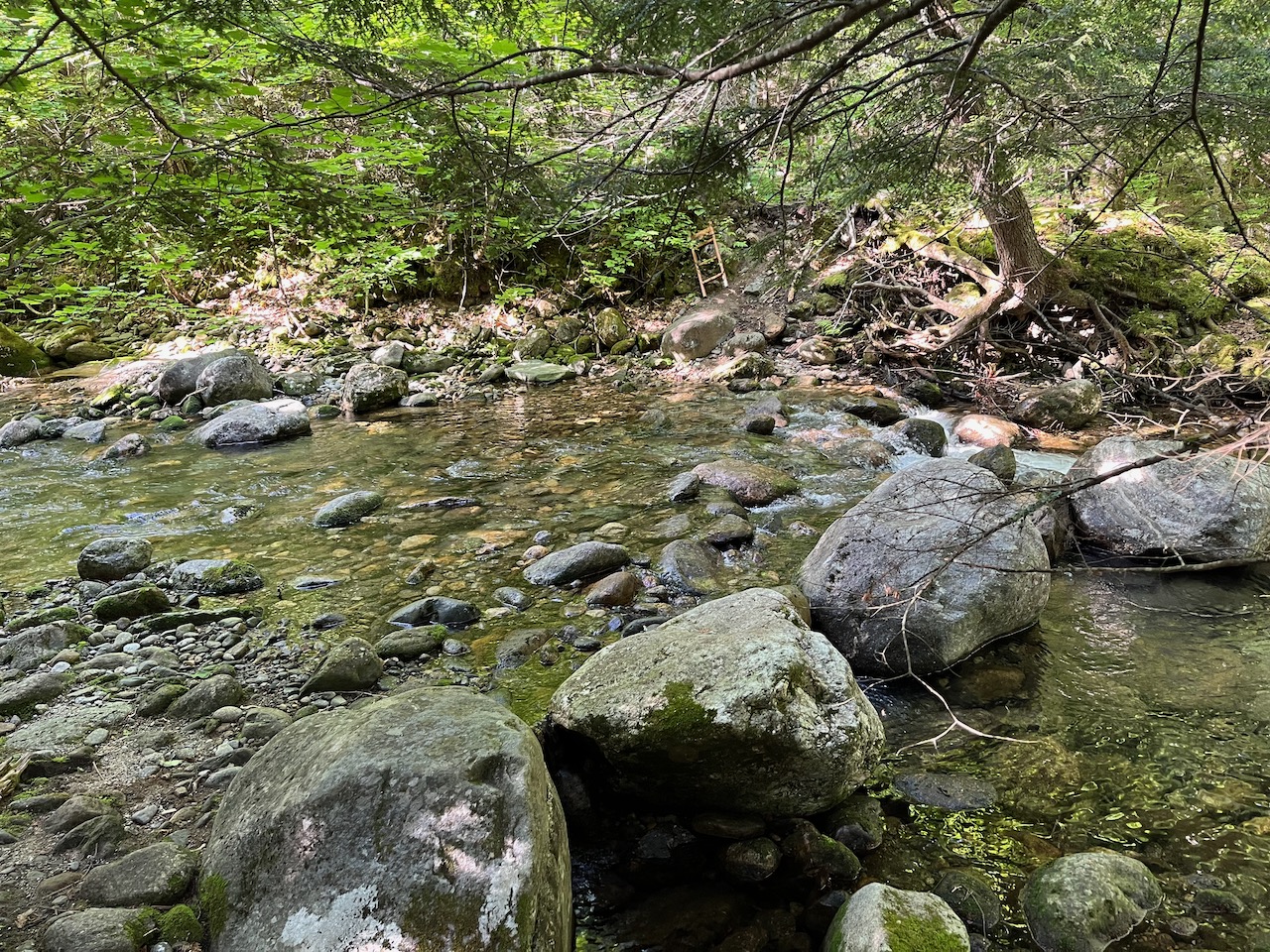
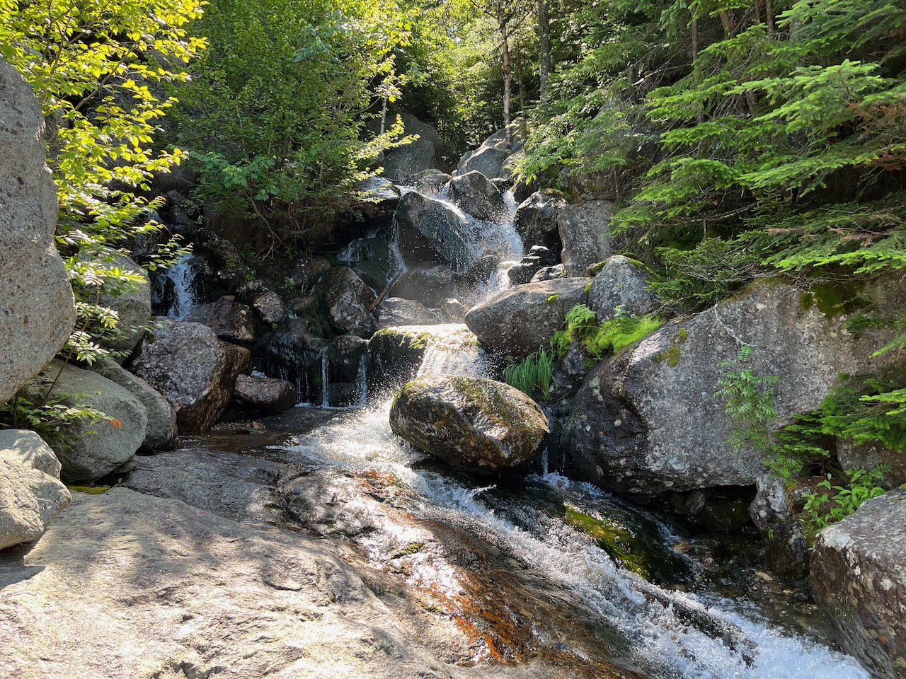
The streams draining from the upper slopes of the Northern Presidential Range into the multitude of great ravines are the source of some of the White Mountains' most fantastic waterfalls. The area on the north of Mt. Adams is especially waterfall-dense, with at least 20 named waterfalls. The tight network of trails pairs well with the waterfalls, as most can be visited by trail. The simplistically named First and Second Cascades don't show up on most maps and therefore are among the more obscure in the area. They're located partway up the Israel Ridge Trail as it climbs through Cascade Ravine. The two cascades tumble a combined 250+ feet on their way down extensive open ledges with views out to the north. Getting to the falls is a bit more challenging than some of the more accessible waterfalls around Appalachia, as you'll have to cross the Israel River multiple times as you trek into the heart of the ravine.
Starting out from the Castle Ravine Trailhead, with views of the high peaks over the field, head down the rail trail to the right past the gate for less than 0.1 miles and turn left into the woods at a sign for Castle Trail. The trail crosses a pipeline corridor, then runs through the woods beside the field (and house). At 0.3 miles total, it crosses through a powerline cut. It re-enters the woods and arrives beside the Israel River. Follow it upstream for a bit, then cross to the other side. The river is shallow and stony here, and the crossing can be very difficult if the water is high. The trail heads uphill on the other side, following the river closely for a bit. The terrain is easy and the walk uneventful for the next 0.9 miles. At the junction, bear left onto Israel Ridge Path as Castle Trail goes straight. It curves around the hillside and descends back toward the river, and after 0.1 miles, crosses it. Once again, stepping stones are small and this crossing can be difficult if the water is not low. The trail stays close beside the river and climbs over some rocky and washed out areas right along the bank. The river is wild and rough as it bubbles through the boulders. After 0.3 miles, arrive at a junction and bear left again, away from the stream. You're staying on Israel Ridge Path as Castle Ravine Trail stays alongside the river. The trail climbs further up the hillside, starting out in a wide open wood. Then, the slope steepens as you enter Cascade Ravine, and the narrow trail angles up across the hill. It becomes rougher and rockier, but doesn't climb too steeply overall.
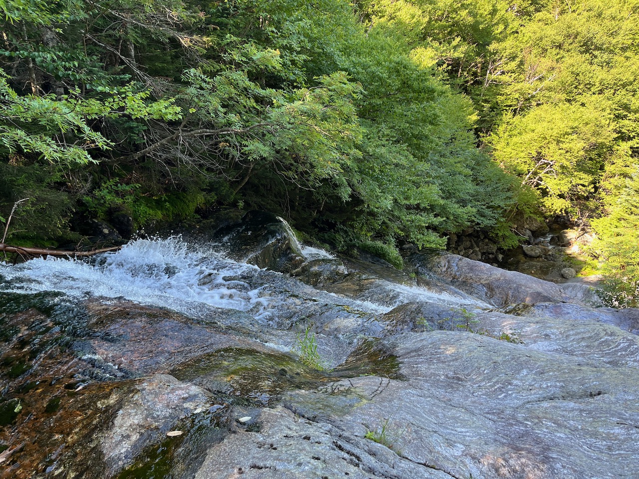
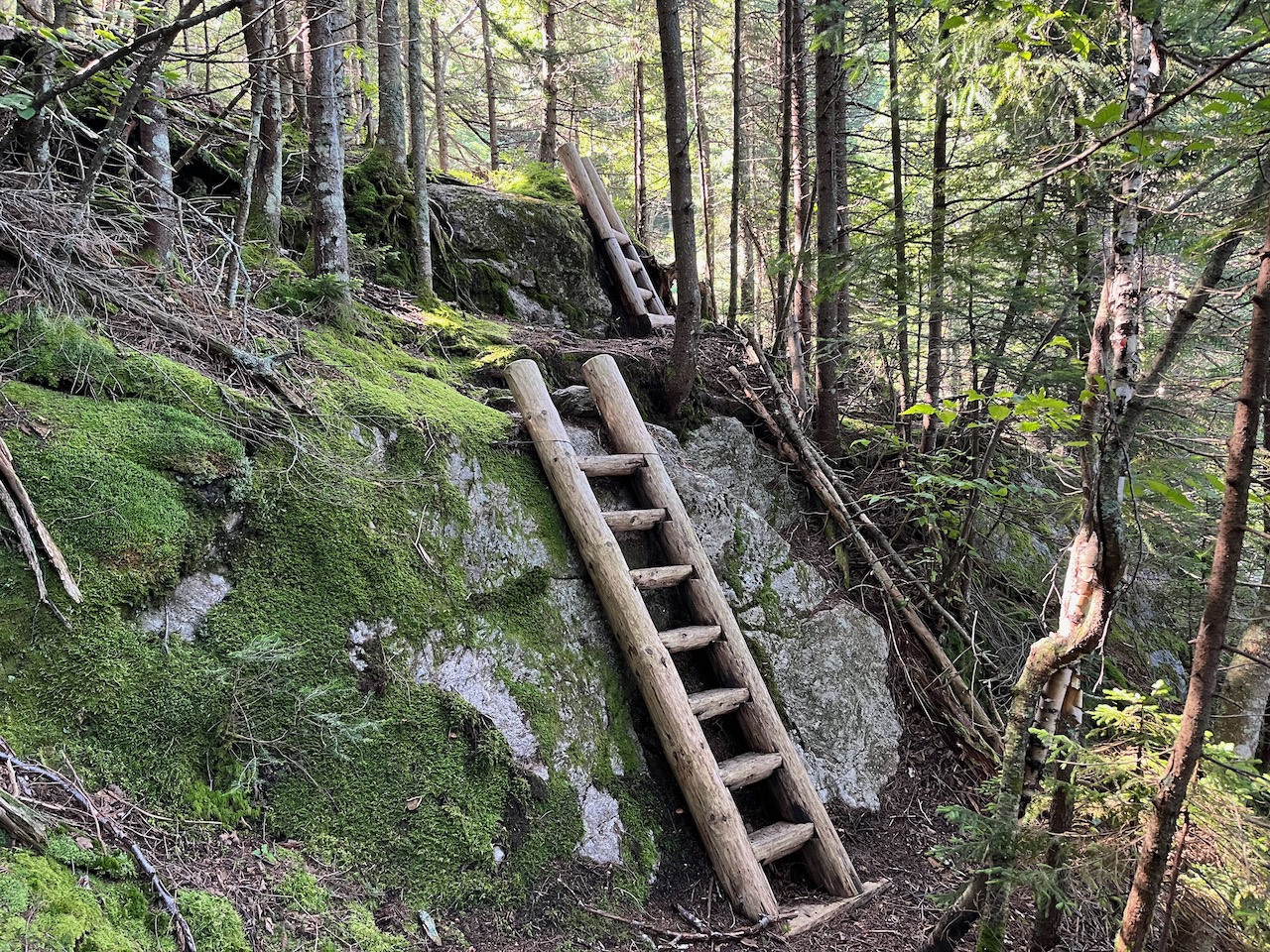
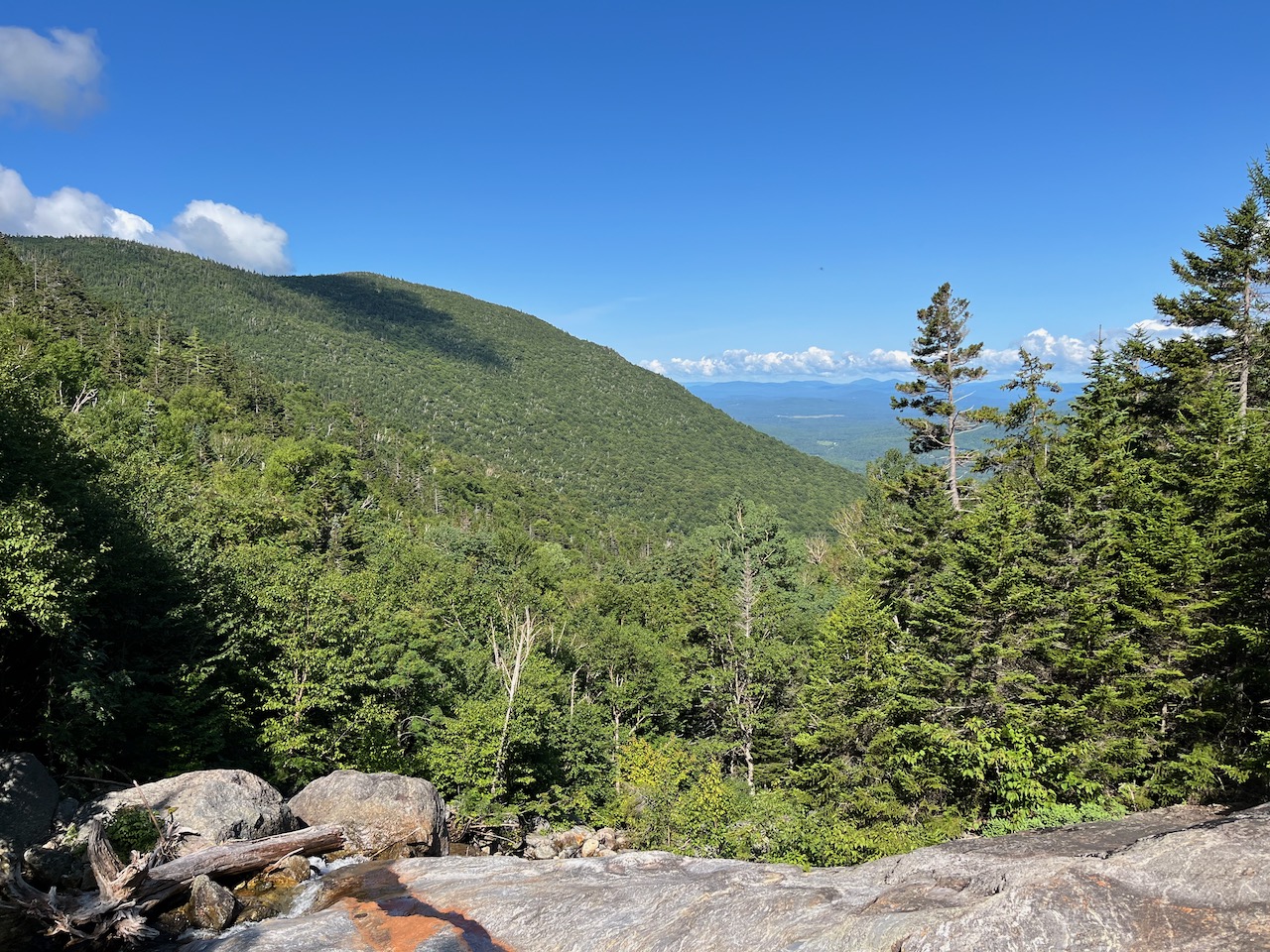
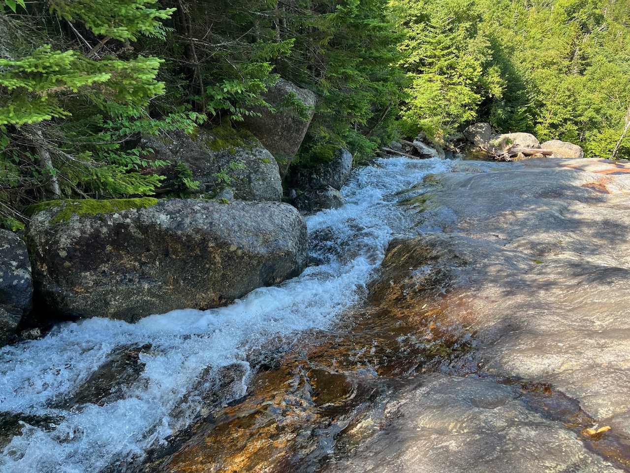
After 0.8 miles, you'll reach a junction with The Link. It merges from the left in the middle of a rock slab that can be slippery. Just a bit further, the trails split again. Bear right onto The Link as it descends toward Cascade Brook, a tributary of the Israel River. This will take you to where the trail crosses this brook, at the top of First Cascade. The brook flows down from the shelter of the tight spruce forest and tumbles down the wide, smooth ledges, ending with a final straight drop. It's quite an impressive waterfall, although it's difficult to access the base of the falls to see the whole drop clearly. Backtrack on The Link to the junction and turn right to continue on Israel Ridge Path. Pass the junction with Cabin-Cascades Trail on the left, and continue up through the rough terrain beside the cascading stream for 0.1 miles. After climbing up a couple small ladders, an opening appears on the right side of the trail, where you can walk out to the much more expansive open ledges of Second Cascade. The brook slides down the far side of the rock; it is a much lesser angle than First Cascade, but larger overall. The pitch is shallow enough that you can walk up and down the ledge alongside the cascades. From higher up on the ledges, there is a nice view out to the northwest. Nearby Mt. Bowman takes up most of the frame, but you can also see out toward Vermont, with Burke and Umpire Mountains appearing prominently. The trail continues right beside the ledges and swings around to the top of the cascades, where the drop begins out from a pile of boulders. Beyond this point, it continues on to Emerald Bluff.
Printable directions page